
Bykasov V. E. Dynamics of the Vegetation Cover Regeneration in the Tolbachik Area // Abstracts of the Field Symposium «Plants and Volcanoes». Petropavlovsk-Kamchatsky, Russia, 9–15 July. Vladivostok, 2001. P. 30.
Valery E. Bykasov
Institute of Volcanology FEB RAS
DYNAMICS OF THE VEGETATION COVER REGENERATION OF THE TOLBACHIK AREA
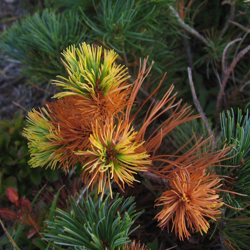
The eruption of the Great Fracture Tolbachik Eruption is one of the most significant phenomena of the XXth century. During that natural ecologic disaster the coverage composed of soil and vegetation was completely annihilated within the area of nearly 500 km2 and some substantial modification of the structure of biocoenosis occured within the area of nearly 300 km2. At the same time the process of mechanic, thermic and chemical damage of vegetation of the Tolbachik Valley resulting from the eruption of the North and South breaches is differentiated according to both its intensity and the range of its influence and the certain mode of influence.No less striking is also the differentiation marked in the character, dinamics and direction of the processes of vegetation coverage regeneration of the damaged sections of the area. For instance, the vegetation of mountainous tundra having occupied practically all the north half of the central and most elevated (800–900 to 1500–1800 m) part of the valley before the eruption was completely interred up to the bed of the Vodopadny (Waterfall) Stream at its west side and to the bed of the right head of the Tolud River at its east side during the eruption. However due to strong winds which removed nearly 0.2 km2 of precipitated pyroclastics in the very first winter the thickness of the slag-and-ash layer upon the sections covered with the vegetation of mountainous tundra decreased practically twice. That is why hardly interred but having not died grass-and-bush vegetation of mountainous tundra has currently regenerated over all the territory where the original thickness of slag-and-ash sediment reached 15–20 cm. And only because of that phenomenon could mountainous tundra move to the center of the eruption so much as 3–5 km.
ДИНАМИКА ВОССТАНОВЛЕНИЯ РАСТИТЕЛЬНОГО ПОКРОВА ТОЛБАЧИНСКОГО ДОЛА
Извержение Большого трещинного Толбачинского извержения является одним из наиболее примечательных феноменов XX. В ходе этой природной экологической катастрофы почвенно-растительный покров был уничтожен полностью на площади около 500 км2, а на площади около 300 км2 произошло существенное изменение структуры биоценозов. При этом процесс механического, термического и химического поражения растительности Толбачинского в ходе и результате извержения Северного и Южного прорывов дифференцируется как по интенсивности и масштабам воздействия, как по продолжительности воздействия, так и по конкретному способу воздействия.Не менее разительная дифференциация отмечается также и в характере, динамике и направленности процессов восстановления растительного покрова пораженных участков дола. К примеру, горно-тундровая растительность, занимающая до начала извержения практически всю северную половину центральной и наиболее возвышенной (от 800–900 и до 1500–1800 м) части дола, в ходе извержения была полностью погребена вплоть до русла ручья Водопадного с западной его стороны и до русла правого истока р. Толуд с восточной. Однако вследствие сильных ветров, которые уже в первую зиму после извержения переместили в центральной части дола около 0,2 км3 выпавшей пирокластики, за 25 лет толщина шлаково-пепловой толщи на участках, занятых горно-тундровой растительностью уменьшилась практически наполовину. Так что погребенная было, но не отмершая травяно-кустарничковая растительность горных тундр в настоящее время восстановилась на всей территории, где первоначальная мощность шлаково-пепловых отложений достигала 15–20 см. И только за счёт этого явления горные тундры продвинулись к центру извержения на 3–5 км.